Hiking the Arizona Trail was a totally unique experience in the realm of hiking. I’d hiked over 10,000 miles, mostly in the East, but Arizona was the farthest west I’d traveled for a trail. Here are some practical observations after hiking 350 miles of it from mid-March to mid-April, beginning at the border and hiking to Roosevelt Lake.

The border. I hiked down to the border with a friend and was glad I did. There was plenty of action. The Miller Peak area can be very active with border hoppers - wearing camo and day packs or wrapped in blankets and wearing Converse sneakers in the snow. Most are carrying gallon jugs. Try to hike the mountain in one day, esp. if it's foggy (like it was for me). Keep an eye on your surroundings at all times. Don't linger. Try to get a very early start and hike the border and Miller in one long day.
Gates abound on the trail. I probably opened at least fifty of them and all with different
mechanisms. Most of the trail lies within pastureland, even though it’s desert
and cattle are grazing, so opening and closing gates are part of the experience.
And get along with the cows. They are on the trail. I sang a song. “Oh, the
hiker and the cows shall be friends” (from te movie Oklahoma! - lol). It worked well.
Learn how to get water.

Of course, we hikers expect streams and creeks, which there are some on the Arizona Trail. But many times water is found in unexpected places, such as troughs, storage bins, water collection devices from rain - of which they are installing several on the trail - and other places. I carried two different methods of purifying (Sawyer and Aqua Mira) as some cow ponds for water are - yes, cow ponds, dung and all. And yeah, you will camp among the cow pies. It happens.
There are a few water caches for hikers. Which is very much appreciated. But do not rely on them. Ever. What gallons may be there on the Far Out app can disappear in just a day or two with hiker bubbles. Don't be caught dry.
The air in Arizona is very dry so it’s vital to maintain hydration. Your skin dries out, your mouth dries out, and your nasal passages bleed easily. Many hikers complained of nausea. It’s vital to maintain hydration and to also take electrolytes, which I never used to do but now am a firm believer. You also must use sun protection. Hat, sunglasses, sunscreen, long hiking shirts. Your skin is susceptible to sun poisoning. Keep it covered. Seek shade as best you can when resting. Do not sit and rest in the sun. And hydrate, hydrate.

I was amazed by the variety of foliage on the trail during this first half – but mostly prickly and burning. Even the trees. A good first aid kit and knife with tweezers are a must out there because you’ll get embedded thorns and other issues. And some of those thorns get easily infected. Make sure you remove them. If you set down your hiking poles and then pick them up, watch hitchhiker thorns. Be ever careful of thorns when setting up your tent and using an inflatable sleeping pad. I carried a thin ensolite foam pad to protect my main pad from prickers. But my inflatable seat cushion didn't make it.
Walking in sandy soil for miles is tough on your feet, so blister
protection is vital. And carry enough socks.
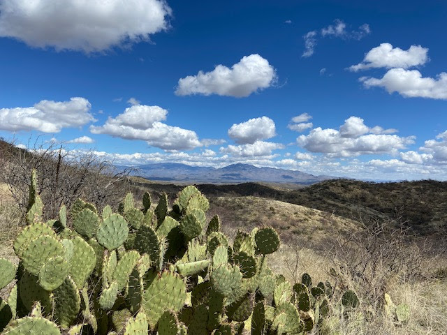
The Arizona Trail is not blazed. It is navigable through rock
cairns, which are all over the place, esp in gorges, scattered signage, and
following the trail on the Far Out app on your cell phone. At times small signposts let you know where the trail is at or small AZT markers. But I got lost in a few places.
And I followed lots of footsteps, except if they went in the wrong direction,
like atop a snowy Mica. I also carried the Garmin Inreach mini, esp in part two of the hike, and was glad I did. Loved ones could follow my progression, and in case of rescue, I was covered.
There are places you need reservations and backcountry permits. Like Saguaro National Park. And of course, Grand Canyon when you get there. Plan accordingly. Both national parks though are great working with hikers doing the AZT.
This trail is not cheap. From air travel to shuttles to mailing
food drops and town stops, along with gear, it’s expensive. Plan accordingly.
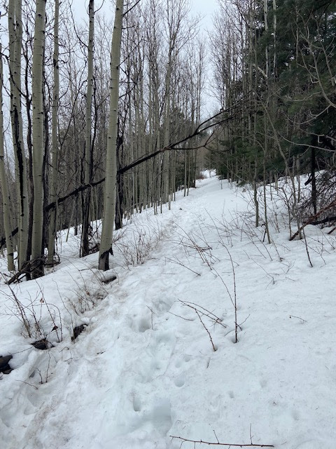
Along the Arizona Trail in March, one can go from snow to hot
desert. You need to be prepared for anything from the 20s all the way up to the 80s, requiring a variety of gear. I did carry EXO spike traction devices
for snow which were only good in the morning when the snow was firm. Slushy
snow which I had on Miller Peak causes you to slip and fall which I did multiple
times. One hiker actually lost his sleeping pad off the mountainside because of
a fall.

2023 was an extreme challenge in the weather because of all
the high snow levels, so I actually hiked the trail in two sections. But
because of those high snow levels, hikers bubbled up into groups, and we got to
know each other. The Arizona Trail ended up being much more of a thru hiker type
atmosphere like the AT - moreso than any other trail I’ve been on in recent
years. And I’ve been on a lot of different trails. So it was nice to have that
feel of an AT community in hiker towns like Kearny, and other places. Trail angels abound, and there is a good Facebook group to connect. And it
was fun running into hikers along the way. We are all out there in it. We’re
experiencing the different parts of the trail. It’s highs and lows. And
learning from it is always the hallmark of a hike.


