 |
| View from Mary's Rock, Shenandoah National Park, VA |
This section began where I left off back in February's hike after a foot injury necessitated an early departure. I decided this time not only to finish Shenandoah NP (for my third complete AT hike of the park) but also to carry on over the "rollercoaster" section on to Harper's Ferry and ending at the home office for the Appalachian Trail Conservancy.
April 11, 2012
Starting: Meadow Spring Parking Lot
End: Gravel Spring Hut
18 miles
This is the spot where I ended my Feb. hike just shy of Mary's Rock along the Appalachian Trail.
 |
| Another view from Mary's Rock |
I had a short climb to a splendid view of the valley and the northern section of Shenandoah. But the clouds did roll in and I found myself being pelted by sleet on my hike into the northern section of the park. My intent was to stay at Hogback Mtn, but with the cold wind and rain, plus few desirable campsites once I crossed the Skyline Drive near the Hogback overlook, I ended up with a long day and hike in to Gravel Springs Hut. Camped out and talked for a bit to Ranger Don who came by.
April 12
Start: Gravel Springs Hut
End: Mosby Tentsite
16.7 miles
I had not planned to hike so far two days in a row, but after yesterday's impromptu stop, I had no choice but to press on to this campsite (which I had never been to, actually).

Clear but cooler day. Passed through the burn areas in Jenkins Gap with the mountain laurel showing signs of life. Not far from this location I heard some noise in the woods and saw a young black bear foraging. Next time I need to just stop and get a picture instead of scaring him off!
Climbed Compton Peak for a view of the Dickey Ridge section of the park and then headed out of the park toward Chester Gap. Did have some fatigue and pain those last few miles - I can tell I'm not in great shape, which I why I'm out here, I suppose.
 |
| Mosby tentsite |
Arrived at the Mosby tentsite to find a sweet place complete with benches and a little spring, perfect just for me! Glad I have a short day tomorrow as I am quite achy after two long days.
April 13
Start: Mosby Tentsite
End: Spring / campsite one mile north of Dick's Dome shetler
12.7 miles
Decided on a shorter day as feet and calves are hurting from 2 high mile days - and two more bigger days to follow. Leisurely pace. Did spot a coyote down the trail from me. Stopped at each of the shelters to sign the register at Denton and Manassas Gap. Touched base with my hubby while enjoying a respite on a bench under a blooming old apple tree. There is nothing like life on the Appalachian Trail!

April 14
Start: Campsite north of Dick's Dome
End: Bear's Den Hostel area
17.2 miles
Up early for another big day of which I plan to hike half the notorious "rollercoaster" part of the trail. Enjoyed blooming trillium and peace through the meadows of Sky Meadows State Park.
 |
| Blooming trillium flanks the trail |
April 15
Start: Bear's Den campsite
End: Harper's Ferry, WV and the ATC center
19.5 miles
 |
| The trail goes through Civil War fortifications |
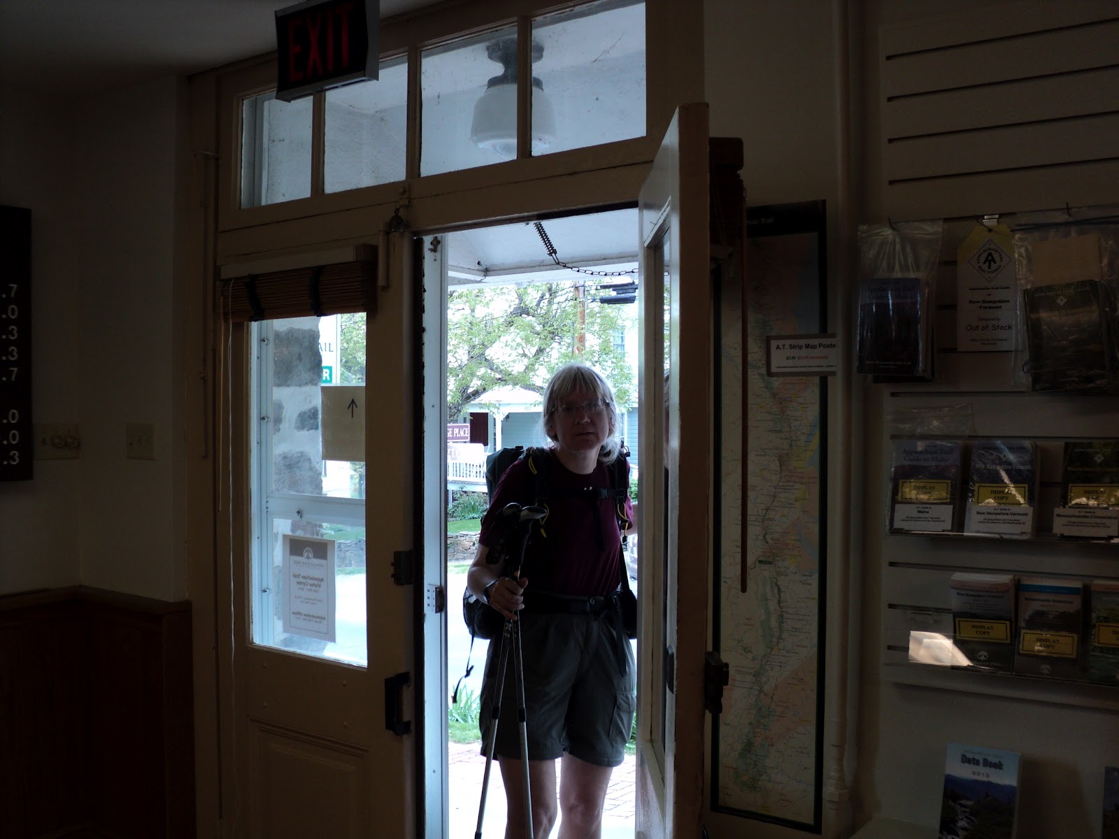 |
| I arrive at the Appalachian Trail Conservancy Headquarters |
3 comments:
How do you know where the camp sites are? I would like to hike from Waynesville to Harpers Ferry next spring, but don't want to stay in crowded shelters/huts.
I have never done a thru hike but have done all of the GA section including the approach at Springer, THIS section sounds like a great section to do!
Gypsy, I use my guidebook and map of the region to let me know where might be the best camping areas. I can understand crowded shelters, but depending on the time of year you go, there is pretty good camping nearby that you can still feel rather isolated. For instance, at Gravel Spring Hut, I was way up in a designated site and only one hiker occupied the shelter. Of course on weekends these areas can be very busy
Post a Comment