Showing posts with label section hiking. Show all posts

Wednesday, May 29, 2024

Appalachian Trail Section Hike – PA and NJ

Continuing my endeavor to complete my third finish of the AT, which began many years ago and because of other trails like the Arizona and Pinhoti. had been put on hold until now. This journey saw me hike from Palmerton, PA, to High Point State Park in NJ, approx 70 miles.

 Day One 


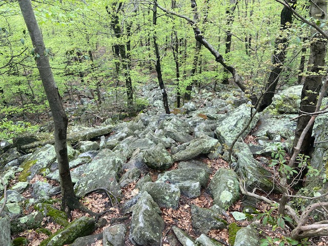
The climb up from Palmerton was just as beastly as I remember. Hand over hand with cliffs jutting out. It didn’t help that several day hikers turned around, unable to make it. I almost lost it and found it extremely nerve-wracking. At least I remembered some tough stuff in the Catskills and finally discovered a side route around one challenging cliff. But found a way through it and kept going


Day Two


Wet, wet. It didn’t help that I had no sleep last night because of a search and rescue around my tent site (I found out later the guy was deceased in his tent probably about a mile from me !). Drones flew overhead and two separate rescuers and a dog showed up at my tent.

It was wet, cold with a cold wind today. Got down to Wind Gap and got a hotel room, the best decision I made. Having a nice Christian lady as the Uber driver who also prayed for me was a nice added bonus.


Day Three

The sun made an appearance, but it took most of the day to show up. Very glad it cleared overnight with a nice wind and a dry tent. Rocky at times.

 Day Four

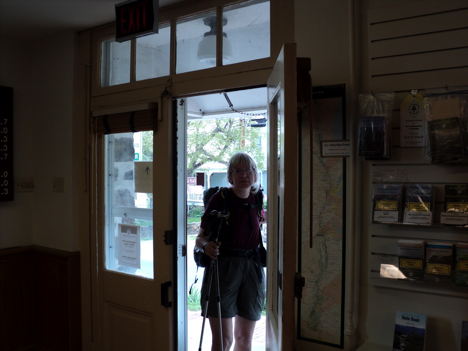
6-mile hike into Delaware Water Gap for the night. The church hostel here has been going for many many years serving hikers. Lots of love. The post office here was a gem and helped mail home gear I inadvertently had left in the bottom of my pack from a cabin trip last week. And didn’t want to carry anymore lol. Stuffed myself with the Stromboli pizza and then headed to the hotel for the night. Seeing February thru hikers now.

 Day Five & Six


A very warm day to cross into New Jersey and onward into the hills. The rocks continued as well as in Rocky ledges. Nothing too difficult though. A rabbit and snake greeted me at Sunfish Pond.Nice campsite at Mohican Trail Center and a blueberry lemon cookie that was out of this world. They even made me veggie smoothie that felt good after an 80-degree hiking day.

The next day had nice views from the rocky ridge walk. New Jersey has some nice viewpoints. Just be on the lookout for snakes.  


Day Seven & Eight


Wet, wet yet again. But the sun came out for my ending pint at High Point State Park for this section. Hope to return in July.


Friday, August 21, 2020

Anatomy of a Section Hike Adventure

Connecting the dots of a trail by way of a section hike to complete a long-distance trail is a rewarding but difficult experience. As a section hiker, you end up basically starting from scratch


every time you go out - with the aching muscles, blisters on tender feet not used to the strain of hiking every day. For longer distances, and if you can manage it, staying out there, you eventually adapt and the aches and pains subside. But for many that is not practical with work and other commitments. The journey of section hiking a trail really is a monumental experience of fortitude and determination.

I am endeavoring to complete a third round of the Appalachian Trail from Georgia to Maine and doing so by way of section hiking. It began back in 2008 and is ongoing to this day, though I have had to curb it quite a bit due to a prior accident, the 2020 pandemic, and other issues that have affected the ability to hike for a length of time. But when I am able, I test myself and attempt a few days out on the trail. This most recent time saw me wandering along a modest portion of trail spanning three states: NC, TN and VA from Rt 19 E to Damascus.

Day 1 – On the first day, coupled with travel, I usually do shorter miles. This day saw me ascend from the road and into the NC woods of which the glory of Jones Falls greeted me with a good waterfall, considering some of the dryness out there.


Day 2 ended up being a longer day hiking along with the simplistic Mountaineer waterfall greeting me, as the trail traversed some of the wetter seconds that required footbridges and wandering through vast patches of rhododendron. I ran into a fellow hiker that told of an available campsite that night and glad for the intel, which is very important on a trail as it can help you plan and provide an excellent place to spend the night.

Day 3 – I journeyed across Dennis Cove road – home to several popular hostels including Bob People’s Kincora where I stayed with my son back in ’07 and stopped by again on my sobo hike in 2010. The trail took me to yet another impressive waterfall at Laurel Fork, and some confusing trail as for about 20 minutes I had no idea where the trail went and began wandering aimlessly along the banks of the river before realizing that most definitely was NOT the trail. The AT ascended Pond Mtn then, quite a good climb and appropriately named with frogs of all sizes greeting me along the trail, reminiscent of what one might see in a pond! The night was a stay at Boots Off Hostel for resupply and a night of tenting.

Day 4 – A lovely early morning jaunt around Watauga Lake made for a pleasant morning walk and then obtaining water early which the added weight did not feel good at all on my sore back. At Vandeventer Shelter I hung out as a strong thunderstorm roared on by until I was able to sneak out and make it to camp for the night.

Day 5 – Passing by the old Nick Grindstaff grave, I thought about the man turned hermit who lived by himself for years on Iron Mountain. I noted from the dates inscribed on the stone he had spent his impressionable teenage years during the terrible Civil War, and I wondered if that experience had any bearing with his decision to live as a hermit later in his adult life. And I thought too of the teens bearing the current Covid crises as I write this and wonder how it will affect them, which is sad to consider.

The trail then took me through lovely pastureland of Shady Valley and a prominent AT symbol on the barn until a return to the woods. I barely had time to set up my tent and partially cook a meal when a terrible storm rolled in, and I endured some of the hardest rain I’d ever been in my tent. I wondered if I would float away. But by a miracle the tent hung in there and I did too.


Day 6 – The after effects of a storm yielded me the beauty of a fiery sunrise and so many different mushrooms it was like earthly flowers of different kind along the trail and I headed for my destination and crossing a state line of Virginia to end in Damascus and the conclusion of this interesting wander.


For more adventures check out Blissful Hiking Adventures for my new podcast and my Hiking Adventure Series of Books!


Saturday, February 18, 2017

Trail Maps – Why Bother?

Being a frequent contributor to hiker forums, I have seen the Appalachian Trail map debate time and time again. And time and time again I see the same reasons crop up as to why hikers choose not to carry maps or even find them an essential part of their gear list -  

Common arguments against taking maps on the Appalachian Trail - 

-          The trail is blazed white and easy to follow. You can’t possibly get lost
-          I know the trail cold, so I don’t need them
-          I never plan to get hurt, face a drought, need a road to bail a friend out or meet a friend, avoid storm damage or any such calamity because my hikes go perfectly every time
-          My guidebook is good enough
-          Maps are too heavy
-          Maps are too expensive
-          Some maps cover such a small portion of the trail, they’re a waste
-          I don’t want to have to rely on a mail drop for a map
-          I can always look at someone else’s map
-          Maps are for whimps
-          Maps are only for those who like looking at something else besides the woods
-          Maps are only good for TP (toilet paper...)
-          Your own special reason…..

Now the Reasons Why you Need a Map – based on the above

-          Yes, the Appalachian Trail is blazed white. But did you know there are places where other areas are blazed white? State Game Lands of PA are. I have seen dirt roads with obscure white or other areas. Just because white blazes often signify the AT doesn’t mean other areas won't also use the same markings. And that can mean you veering into other areas with the potential of – uh – getting lost. Also, many designated wilderness areas have infrequent trail blazing. Or blazes are obscured due to rerouting or lost over time. It’s easy to miss them at road junctions. Or pranksters could have obliterated them. In different seasons trails can be hard to follow and blazes spaced far part or gone by blowdowns or chipped bark. Or fresh snow obliterates them. 
-          So you never plan to get hurt or encounter adverse weather which may necessitate your need to bail out or emergency camp at a place that has water? A map will show you areas that may suffice for an emergency campsite. Maps help point out road crossings or alternate trails that can lead to bail-outs and safety if you or a friend need them. Or if you run low on supplies. Maps help show detour routes if the trail is blocked by severe storm damage (i.e. hurricane damage in season or fire season when trails close) or high water from a t-storm. Maps also help locate adequate, uncontaminated water sources where reliable ones in a guidebook may not be flowing. Essentially, maps could save your hike and maybe even your life
-          Guidebooks are giving elevation profiles of the trail but don't have the other features a map contains. They do not have contour lines. You don't know for sure where that trail is really going from a guidebook. There are no side trails outlined on it except in verbage. They don't always point out all upcoming road crossings and trails, nor do they tell you where they lead. They cannot pinpoint obscure water sources you may need, esp in drought conditions or in beaver fever areas. Guidebooks provide words not visual illustrations of the trail and its surrounding areas
-          If you think a tool that could help you or save a life is too heavy, then maybe your aren’t cut out for the rigors of hiking
-          Ditto for $$. You’ll spend it on other things, maybe even brew or tobacco, but not on a map. Priorities - ?
-          Maps are never a waste if they are needed. OK – you may have been fine on a section without them. But no doubt the one time you need it, you won’t have it. 
-          Mail drops are fine for forwarding paper maps  lots of places besides the PO will take them. Another option is a trail map phone app. I have used this successfully on the Florida Trail. They are excellent resources and with lots of info about waypoints, water sources, towns, etc. 
-          Sure you can look at someone else’s map, but why not have your own? This is your hike. Carry
your own stuff and be self reliant. If you ask me, the whimp factor in the next response can also apply to the one who refuses to carry a map then must rely on another to provide it for him / her.
-          I believe the other answers are addressed above when one see the value in a map. Also, maps are part of Leave No Trace, that is, planning for your hike. Maps can be life savers. I have never known a hiker having to quit a hike because of carrying a map. But for sure some have had to quit because they did not have one – i.e., they got lost, they got hurt and didn’t get medical attention in time to help the injury, had to take an unintentional detour or other reasons.

Bottom line is, be prepared and take some form of a map.

Google clubs for the trails you wish to hike to look for maps

Guthooks Map App   

Tuesday, February 10, 2015

Lessons from a Winter Weekend Section Hike


Lots of views and lots of mountains too in this section
I am in the process of completing my third trek of the Appalachian Trail via section hiking. So far I have walked from Springer Mtn (the southern terminus) to outside of Erwin and from Crabtree Falls Rd in VA to Pen Mar Park, PA. For this trip I decided to piece together a bit more of VA, taking it from the Tye River (or about five miles north of Crabtree Falls Rd) to the James River. I elected to do the trail southbound because of shuttle availability, and as I would discover through the course of my wander, it was the correct choice. 

What is the saying about how a man plans his way but God directs the steps? It proved quite true. We’d had some good melting of any previous snowy precip, so I had to make a decision whether to bring traction devices for my shoes or not (like my Yaktrax). Seeing the bare
An icy trail and no traction devices!
woods up at 2500 foot elevation in Shenandoah, I elected not to carry them. But one doesn’t realize that snow and ice are slow to leave the north facing slopes of the mountains. So it was on this section hike as I faced icy trails and no traction devices. But when one goes southbound, you go UP the north side of the mountain, and that was the lifesaver of the hike. It’s much easier with momentum to go slipping up an icy slope rater than trying to sneak down. So I was able to do it, even though I was kicking myself for not carrying the traction devices in early February.

I also discovered that while guidebooks are a must to have on any hike, long or short, there can be some discrepancies. A campsite I thought would be there as outlined in the pages had a NO CAMPING sign posted in it. Ok, so onward I went. Except the trail takes a meandering approach around the Lynchburg Reservoir with hills on either side for several miles. There was NO place to camp, and daylight’s burning (it gets dark early in winter nights). I finally found one small sag in the trail by some boundary markers and threw up my tent there. Better safe than sorry. But with night falling, I now attempt to locate a rock to toss up my bear rope – none were found anywhere. Then a thought occurred to me—use my water bottle. So I did, and it worked fine. After 4,000 plus miles of trial it was the only time I ever used my water bottle to help hang the rope for bear bagging!

On day three of my wander, I was to be picked up at the James River. It wasn’t until I finished the section and dealing with very sore  muscles that I realized how much elevation I had accomplished AND the mileage I had put in a simple Friday to Sunday wander (47.6). It was a bit extreme to say the least. I guess I’d rather be hiking, even if I’m sore, then get to camp early and sit there shivering (at least the final day of the hike warmed up to the sixties!). Now I pay the price as I recuperate from an arduous adventure that saw me again dealing with new situations every time I go out.

On the lighter side of things, I am glad for several gear choices for the trip:

My new LUCI solar charged lantern when those nights sneak up on you quick

The lantern glows as darkness falls


Terramar silk baselayer as a secondary baselayer for very cold nights (and also very ultralight)


Woolx midweight merino wool socks that performed beautifully for two solid days of 30 plus miles with a great cushy feet and zero blister issues afterwards (I highly recommend them and will likely follow-up with a SOCK blog soon on my favorite brands for hiking). 


Related blogs:


Friday, September 12, 2014

Guest Blog - A First Timer Observation of an AT Section Hike

Our First Section Hike on the Appalachian Trail...what did we learn?

My husband and I just returned from our first section hike on the AT. We've hiked before but not for this amount of time. Our initial plan had us starting at the NH/VT line in Hanover and ending at the VT-103. We would hike for 5 days then take one overnight at the Inn at Long Trail then hike another 4 days. Our actual hike included a 4 day hike, 2 nights stay at the Inn at Long Trail another 2 day hike and another 2 nights stay at the Inn at Long Trail. I researched and planned (and had two back up plans) for this section hike for a year. We spent more money than I want to mention on gear,


travel, etc. I read and re-read advice on this site and others and we only followed some of that advice. So what happened? Here is what we learned...

1. We are slower than everyone else on the trail. See #2 for pack weight. But even when we lightened our packs we were a lot slower than everyone else. Once we remembered the phrase Hike your own Hike we were able to relax and enjoy. You will see everyone from runners, day hikers, thru hikers, section hikers etc. on the trail. Some will be faster than you, most will go farther per day than you but none will be slower than my husband and I !!


Monday, April 23, 2012

Section Hike, Appalachian Trail - Shenandoah to Harper's Ferry

View from Mary's Rock, Shenandoah National Park, VA

This section began where I left off back in February's hike after a foot injury necessitated an early departure. I decided this time not only to finish Shenandoah NP (for my third complete AT hike of the park) but also to carry on over the "rollercoaster" section on to Harper's Ferry and ending at the home office for the Appalachian Trail Conservancy.

April 11, 2012
Starting: Meadow Spring Parking Lot
End: Gravel Spring Hut
18 miles

This is the spot where I ended my Feb. hike just shy of Mary's Rock along the Appalachian Trail.
Another view from Mary's Rock
 
I had a short climb to a splendid view of the valley and the northern section of Shenandoah. But the clouds did roll in and I found myself being pelted by sleet on my hike into the northern section of the park. My intent was to stay at Hogback Mtn, but with the cold wind and rain, plus few desirable campsites once I crossed the Skyline Drive near the Hogback overlook, I ended up with a long day and hike in to Gravel Springs Hut. Camped out and talked for a bit to Ranger Don who came by.    


April 12
Start: Gravel Springs Hut
End: Mosby Tentsite
16.7 miles

I had not planned to hike so far two days in a row, but after yesterday's impromptu stop, I had no choice but to press on to this campsite (which I had never been to, actually).


Clear but cooler day. Passed through the burn areas in Jenkins Gap with the mountain laurel showing signs of life. Not far from this location I heard some noise in the woods and saw a young black bear foraging. Next time I need to just stop and get a picture instead of scaring him off! 

Climbed Compton Peak for a view of the Dickey Ridge section of the park and then headed out of the park toward Chester Gap. Did have some fatigue and pain those last few miles - I can tell I'm not in great shape, which I why I'm out here, I suppose.

Mosby tentsite
Arrived at the Mosby tentsite to find a sweet place complete with benches and a little spring, perfect just for me! Glad I have a short day tomorrow as I am quite achy after two long days.

April 13
Start: Mosby Tentsite
End: Spring / campsite one mile north of Dick's Dome shetler
12.7 miles

Decided on a shorter day as feet and calves are hurting from 2 high mile days - and two more bigger days to follow. Leisurely pace. Did spot a coyote down the trail from me. Stopped at each of the shelters to sign the register at Denton and Manassas Gap. Touched base with my hubby while enjoying a respite on a bench under a blooming old apple tree. There is nothing like life on the Appalachian Trail!         


I managed to find a lone campsite just north of the spring near Dick's Dome with trees in bloom above my tent. Here early to rest up my legs, and glad I did as I felt much better the next day. Plan to see my hubby tomorrow near Bear's Den.

April 14
Start: Campsite north of Dick's Dome
End:  Bear's Den Hostel area
17.2 miles

Up early for another big day of which I plan to hike half the notorious "rollercoaster" part of the trail. Enjoyed blooming trillium and peace through the meadows of Sky Meadows State Park.

Blooming trillium flanks the trail
The rollercoaster is a series of ascents and descents with minimal views from rocky outcroppings. Some of these "hills" are worse than others for their steepness. Several have nice streams running through the middle of them. Still I was pretty tired by the time I got to Bear's Den where I was met by my hubby. We went to Horseshoe Curve restaurant for dinner, then back down the AT to find a campsite just below the hill for Bear's Den. Tomorrow I plan to "slack" the remainder of my trip into Harper's Ferry (that is carry, a daypack rather than all my backpacking gear).


April 15
Start: Bear's Den campsite
End: Harper's Ferry, WV and the ATC center
19.5 miles

The trail goes through Civil War fortifications
Early start where Steve (Papa Bliss) met me on the road and had breakfast waiting for me. Stripped down my pack and carried only what I needed to finish the rest of my hike in this section. Completed the remainder of the rollercoaster section and onward into West Virginia. Loudon Heights has fine examples of Civil War fortifications still preserved from that era long ago. I also saw some old trees I believed did "witness" the action that happened here. While on my hike, I sent my hubby to meet my co-ridge runner for Maryland and he volunteered at the ATC center there for the afternoon. Thus when I arrived, he took my picture, and we celebrated with a great Chinese buffet in Charles Town. Good time in God's creation. 

I arrive at the Appalachian Trail Conservancy Headquarters

Sunday, May 08, 2011

Southbound Finished!!

What began as a section hike in Shenandoah National Park southbound in the fall of 2008 has turned to a completed hike of the trail from Maine to Georgia! The hike was done over the course of several spring and fall hikes, culminating in 70% of the journey hiked in the summer and fall of 2010, including the summit of Katahdin in July 1 and a summit walk of Springer Mt in Georgia in early November.


I had to leave PA and MD until the following year because of family commitments and work. I began the final weeks of my adventure in early April, finishing the hike on May 6th in Harper's Ferry, West Virgina. And the great people at the Appalachian Trail Conservancy celebrated the day with me, including breaking out the bubbly just for me! Wow, was it a special time.


Here's to over 4,000 AT miles completed and future adventures that still await!

Thursday, February 24, 2011

Southbound vs Northbound Part II - The Social Aspects


Day One on the Approach Trail to Springer Mtn, GA March 5, 2007

Yes, there is nothing like the solitude of a wilderness experience. The flora. The fauna. The views. The fresh air. The ability to leave homes and cities, and smog and Internet and live free with just a backpack and a few bare essentials.

But there are people.

Yes, the trail is still filled with people. People of all walks of life. People on the trail, at the shelters, in the hostels, in towns, on the roads. Thru hikers, sectioners, day hikers, weeekenders, townsfolk, trail angels, hostel providers, shuttlers. The variety is endless. And so are the contacts one makes.

Tents abound in thru hiking season come late March.
I believe the social aspects is what sets the Appalachian Trail apart from more remote regions where trails wander without a soul in sight for days on end. Not to say you won't ever be alone on the AT. You will be, whether going north or south. But there is definitely a difference in social living in a NOBO vs SOBO hiking experience. And things one might consider if you are pondering NOBO vs SOBO. If you lean toward being a social bird and like social things OR if you are one of solitude and want to experience trail life with just yourself as company. I have done both and came away with different experiences.

SOBO Hikers that Began July 1 or late June gather at Antlers Campground in the 100 Mile Wilderness, July, 2010


Going Southbound (SOBO)

Hikers heading southbound have a narrow window of opportunity if they plan to hike the whole trail. Depending on weather on Katahdin in Maine, the northern terminus, hikers can start anywhere from late May to mid July with most heading out between June 15th and July 1 for optimal season conditions and to avoid snow down south. Southbounders are also faced with difficult challenges right off the bat - the most difficult parts of the trail in the first six weeks of hiking and little in the way of resupply, refreshing or even changing out gear. Hikers come in as newbies without trail legs and must hike the toughest parts of the trail where most say 90% of the work remain. And this is bound to cut down on the social aspects of the trail as hikers start to fall behind, drop out, etc. We happened to leave on a popular start date - July 1 and were in with a bunch of SOBOers all throughout the 100 mile wilderness. Some of the NOBOS we ran into in southern Maine were blown away by our contingent. But the group quickly dissipated soon afterwards as the toughness of terrain seeped in. People's mileage varies as does their desire to stay in the few towns that exist in Maine. When I began in July, by the time I reached NH (and having to get off a week myself for family issues) I was alone going Southbound by August. There were a few ahead of me. Some behind. The ones that began in June were way ahead. But I was on my own. And I remained that way throughout my hike with only occasional sightings of fellow SOBOers in my travels. I did run into Northbounders up until Vermont. But they were all giddy with their miles behind them, and I was in the beginning of my task, so to speak. They were of a different mindset, and I could not relate to them per say.

Trail services were also different for the SOBOer. Everything is geared toward the Northbound hiker. The stores, the hostels. Many were closing up by the time I got there or were closed, including shuttle services. And very little in the way of Trail Magic (where thoughtful folks leave food and fluid at times for hikers at road crossings). People were wondering why I was out there when no one else was. It was a one on one experience for sure. Especially after September when most hikers were back at jobs and schools and sectioners began to drop off (there were a lot of sectioners in September and early October, but again, all were going north. It was my observation that no one hikes south.). I was alone many times at shelter areas or campsites. It was just part of the Southbound experience.

I would definitely say if solitude and independence without support is your key, then Southbound is the way to go.

Going Northbound (NOBO)

If social activities, friends, etc is the rule for you on a long distance hike, then you must go north. Everything is geared toward the NOBO thru hiker. All the stores, the hostels, the shuttles, the trail magic is out there to enjoy. You really have no excuse in the over and abundance of support to keep this hike going, because support is everywhere. And so too are crowded shelters and hostels, and sometimes even services. Though when I did the trail starting in early March, I came through many of the towns before the main onslaught of hikers (which is usually March 15 to April 1st).

If you want a friend to hike with, going North it's easy to find one. And many times the first day or two. See the initial picture at the beginning of this blog and the two hikers we met up with on day one of the Approach Trail on March 5th (without even setting foot on the AT itself). Though a few times my son and I did eventually find ourselves alone on the hike north (mainly in PA). We spent very few nights alone in a shelter (I think three maybe?). And even if there aren't thru hikers, sectioners are out in full force in summer. We had sectioners with us throughout NJ and NY into CT and beyond. And made some great friends. For some reason everyone hikes the trail north. And so there is little trouble with having an active social life, if you want one.

There you have it. The trail is a slice of the good life. As is the great people you meet along the way. And whether north or south, it's a great place to be.


Other Related Blog:

Part Three of the Series - Outfitters and Resupply
Observations of a Two Week Appalachian Trail Start

Friday, January 22, 2010

Section Hike - Rockfish Gap South to Crabtree Falls Road

I realized I had not yet updated my fall section hike on the AT to include the latter part I decided to finish a week later after recuperating from foot injuries. Here is the report of the hike, taken from my written journal.

October 21, 2009
From: Rockfish Gap
To: Campsite south of Humpback Rocks Picnic area
13.2 miles

I was going to finish the hike of this section on the weekend, but with bad weather on the way, I decided to do it a few days earlier then planned. A fairly uneventful hike, though I am having toe pain from crushed toenails and the right toenail is leaking fluid. My left ankle is showing signs of weakness also as I stumble over small rocks on the trail - will need to work on strengthening it at home. Saw fall views from Humpback Mtn - really pretty with fall colors. Saw a nice campsite too but decided to hike on closer to the picnic area. My water situation is not good (down to a mere pint) and may have to backtrack to the picnic area tomorrow in hopes the water is still on as it is very dry out right now. Found a small area to pitch a tent and a nice rock to cook on. Managed to get enough of a signal to let my hubby know where I am. Seeing lights from the Wintergreen Resort. Tomorrow is the notorious Three Ridges area.

My tentsite a half mile from the picnic area on the ridge

October 22
From: Campsite near Humpback Rock Picnic Area
To: Harpers Creek Campsite
14.2 miles (including a mile round trip for water)

Up early to backtrack to the picnic area in the hopes the water is still on. Thankfully it is and I fill up as well as take a nice, long refreshing drink. Hike on over some treacherous rocks slabs (pictured below) where the trail should really be rerouted into the woods, IMO. This is really ridiculous.


Hiked out to the Blue Ride Parkway and crossed over to be treated to nice views of the autumn colors on the distant ridgelines. And yes, plenty of rocky areas to climb over, reminiscent of my jaunts back in '07 in PA. Climbed to the Maupin Filed Shelter from Rice Gap and although I had been here several times, everything looks different in a new season. Began the climb of the Three Ridges to a splendid view of The Priest and the Tye River valley off Hanging Rock, and a view I also missed when I did this section last.


The Priest from Hanging Rock in the Three Ridges Wilderness

The hike down off the ridges is very long, steep, with many rock slides to negotiate, and really, too much on knees that are not used to such strenuous activity. Hence by the time I reach the campsite that night, I was having quite a bit of knee pain. Obviously I had done too many miles for the terrain, and also not enough rest stops. Lessons learned on this section hike.


October 23
From: Harpers Creek Campsite
To: Crabtree Falls Rd, Tye River Rd Intersection
12 miles (including decent down Crabtree Falls trail to the parking lot)

The day dawned cloudy with a promise of rain, but thankfully I got my gear packed up before anything fell from the skies. Knee is bothering me quite a bit from yesterday's hike, so have to take it really easy on downhills. For the first time, I'm glad for the steep uphill on the Priest as downhills are killing me. Cross over the Tye River and begin my ascent of The Priest when the rain falls. At the summit, the conditions deteriorate rapidly with rain, and wind. Feeling quite cold. Hard to see in the thick fog. Manage to make it to The Priest shelter for lunch, though it is hard to stay warm. I must admit I am glad this is my final day on the trail, between the wind and rain and my knee.

Begin descent down Crabtree Falls Rd and Crabtree Falls trail. The wind dies down which makes it easier to deal with. But the drought has taken its toll as there is not much water flowing over


the falls. A shame. Head down the trail until I hear my name called, and it is Skipper, ready to take me home.

Section from James River to Rockfish Gap is finally completed for the Fall. Have now done as part of a SOBO section hike - Chester Gap, VA to Catawba, VA. Much more to go!

Friday, October 16, 2009

Section Hike AT - James River North

At the start - James River, elev 735


Rocky Row area overlooking James River, elevation 2992

October 11, 2009
James River to Rice Mtn
13.1 miles

Okay, so I thought I could get away with another section hike on my pair of trail runners that I knew were close to biting the dust. Hoped to do James River to Rockfish Gap. Trip started okay Sunday, though being out of shape with hiking is quite evident when trying to hike miles and do elevation change. Plus a loaded pack with supplies for five days (ugh) and water since you don't know spring conditions with the dry fall we've had. The spirit in strong but the body weak. Thank goodness for Advil. Still made it to Rice Mtn for an overnight stay after seeing good views of the James River.

Cold Mountain, elevation 4022

October 12
Rice Mtn to Hog Camp Gap
15 miles

The next day dawned cloudy but still good views as I hiked around the reservoir and enjoyed autumn color. Had some hot spots so put on the customary duct tape. But noticed too on dowhills my toes jamming and some nail pain (didn't think really to tighten the laces more). Thought it would go away (that invincible streak). Climbed the nice long hike up from Rt 60 and was met with foggy and very windy conditions on Bald Knob. And continued aches and pains. Duct tape falling off my feet, not good. And just general feet pain. Did clear enough though for views off Cold Mtn, but again, the pain muted it. Arrived at Hog Camp Gap to inspect the feet and found one quarter size open and draining blister on the big toe - have no idea where it came from except it must have happened from loosened duct tape. Fixed my feet and set up camp. The rain held off though and had a quiet but windy and cool evening as I cooked by the tent. Later that night dew fell with condensation in and out on tent, and wind caused a stake to come out, so up at 4 AM to fix it.

October 13
Hog Camp Gap to Crabtree Falls Rd
13.7 miles

Tired today from the escapades of last night but awoke to a bright and beautiful morning with the autumn colors vivid in the sunlight.

Thought today would be a good day. Felt okay. Managed to bandage the big toe fine but to my dismay, found another blister forming, this time on the sole and the junction of one middle toe. As teh day went on, the blister proved impossible to bandage correctly as whenever I put tape on, it would fall off. And come to find out, a ridge that had developed in my runners because of useage had formed the blister. So day three I was met with constantly stopping and doing first aid. My big toenails were not good either. My gait was changing becase of these issues and then I was facing ankle pain from an old ankle injury. Stopped at Seeley shelter to dy out tent and do first aid. Spent over an hour there. But the hiking didn't go well after that with the ongoing foot problems. At Spy Rock Rd, I told my hubby what was going on and he urged me to get off. Now getting off is not what I wanted to do. I hemmed and hawed. But every step really hurt and I was not enjoying this time at all. Nor the prospect of climbing down the Priest with bruised toenails and then walking on the blister over the Three Ridges and beyond. I feared also the gait change could cause more ankle problems (and I was recently recovering from an ankle spain in Sept. after a tumble off the steps).So I got off at Crabtee Falls Rd and got picked up.
Lessons learned - don't use worn shoes and insoles, take better blister stuff to work with. Tighten your shoes and wear good socks.

Wednesday, May 13, 2009

AT Section Hike - James River to Catawba Part II


April 14, 2009
Cove Mt Shelter to Wilson Creek Shelter
13.7 miles
Overcast, mist

Had a pretty good night with only Signage and me in the shelter. Rained most of the night, so glad we were safe inside. Woke to overcast, foggy conditions with a light mist, but all part of the AT adventure as are the sunny and bright days too. Donned rain jackets and pack covers and trekked onward. Only had a few short bouts of real rain, but did miss some of the lovely views from the overlooks. Met a few NOBOs at Bobblett Gap shelter and a few more after that when we arrived in mid afternoon at Wilson Creek Shelter. They had all started in mid to late Feb and were enjoying their time, if coping with a lot of rain this season. It is interesting to hear of their adventures and encouraging them to make it all the way to Maine. Now I am looking forward to going to Signage's house tomorrow night for a shower and laundry. And Thurs. and Friday look good for our next section with my friend I met on Facebook, Beth.


April 15th
From Wison Creek Shelter to Daleville
11.2 miles
Cloudy to clearing

Rained during the night, so once again we were glad to be under cover in a shelter. Packed up and headed out in foggy conditions to find it soon clearing with views looking out to Daleville and the surrounding ridge. Ate lunch at Fullhardt Knob shelter then proceeded down the trail and through farmer's fields to reach Signage's SUV parked at the Kroger. She then took me to Salem and showed me her town and her little house. A shower never felt so good and it was good to have clean clothes. We then went to Mac and Bobs for a nice chicken parmesan dinner that proved too much on our fragile stomachs used to eating trail food. Had a good night's sleep.


April 16
From Daleville to Lambert Meadow Campsite
10 miles
Sunny

Went to a nearby coffee house for bagels where I had decaf blueberry brandy coffee - a first for me, I must say. We drove to Catawba where we met Beth for the first time and left one of the cars, then piled into Signage's car to drive to Daleville and our starting point for this leg of the trip. I had hiked one mile of the AT when I realized I had inadvertently left my insole in Signage's car. Jogged it back to the car through thick mud to retrieve it, then met up with the others to continue on. Thankfully we are not doing high stressed mileage! Beautiful views from the ridgeline, much different then when I had done this section twice before. I had a feeling I was going to enjoy this. Nice, relaxed pace where we stopped to admire the views. Found a place to camp by a stream near the Lambert Meadow shelter. That night, Beth got her trail name Lucky as it wasn't too cold and she had not packed exactly the right clothing for a night out in mid April (no jacket, etc). So we decided to call her Lucky.


April 17
From Lambert Meadow Campsite to Catawba
10.2 miles
Sunny

Awoke to another bright and beautiful sunny day on the AT. Hiked the Tinker Cliff area for outstanding views. Lucky bothered by allergies and had taken Benadryl so she stopped often to snooze along the way. Again glad for a relaxed schedule. Ate lunch midway between Tinker and McAfee Knob, then went up the knob for the customary picture. Found a nice campsite down by Catawba Mtn shelter to set up, but were soon infiltrated by Boy Scouts and decided to hike out as our car was only two miles away. Unfortunately I hiked a bit too fast in the dark and ended up spraining my ankle, but managed to hike it out and back to Signage's house for ice and a night's rest.

Had a great hike on this section and great companions.