Showing posts with label West Virginia Hikes. Show all posts

Monday, October 19, 2015

West Virginia’s Long Trail – Thru Hiking the Allegheny Trail (ALT)

For my big hike this fall, I tackled the 300 plus mile long Allegheny Trail that spans the
Monongahela National Forest of West Virginia, starting at the PA border and stretching southwest until it reaches its southernmost terminus with the Appalachian Trail not far from Pearisburg, VA. It winds its way through some interesting and beautiful scenery – such as Blackwater Falls State Park and giant hemlocks, old coal towns, canyons, and ridgelines. It has a shelter system also of eight shelters. There are resupply points and friendly townsfolk (who may not understand WHAT you are doing but who want to help anyway!!)

It is important to note though this trail is NOT the Appalachian Trail with a well-trodden trail and white blazes heralding from tree trunks every 100 yards. Few people traverse this trail. There are places where you can hardly even find a trail. Some of the tread work on the hillsides is very narrow. In some areas the blazing too is very faint. It is a much more primitive trail in many aspects and thus one needs to be prepared for a primitive experience. There are blowdowns to amble over or under. 
Blowdowns are par for the course on a primitive trail
Heavy vegetation. Thorns. It is like the AT once was some 40 years ago with road walks, and friendly townspeople letting you stay places and trying to navigate a trail using maps and common sense. It takes determination, patience, and the ability to reason things out.

The website for the Allegheny Trail (see link below) provides the would-be hiker with a guidebook (yes it's over 12 yrs. old) and maps (fairly accurate). There are also multiple pages you must download and print up the updates (of which there are many). Hopefully soon they will actually update the guidebook as a while, but until then, you must download all the available info offered so you know where you are going (there are several reroutes in place that the guidebook and maps do not cover.

As I mentioned on this trail you need to use your common sense. Section One is mostly road walking and yes the blazes can sometimes be few,
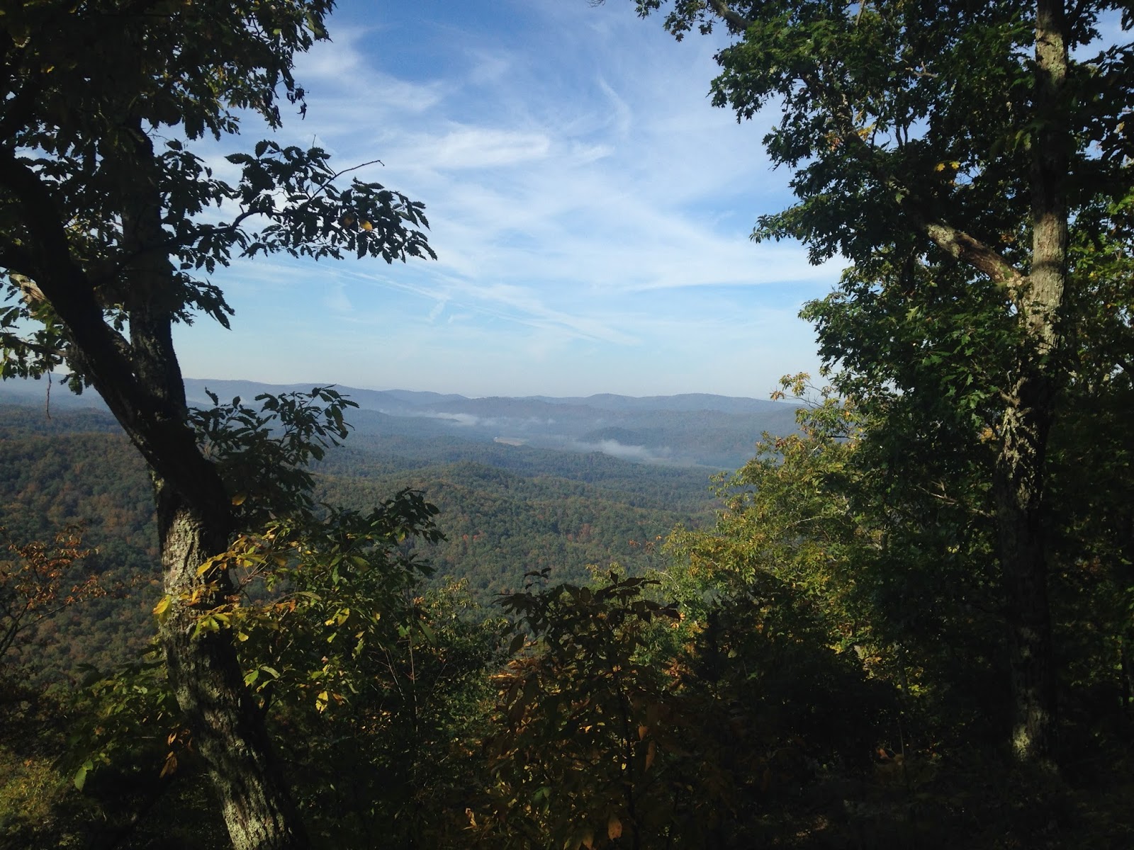
View from Middle Mtn
but follow the map and guidebook to help you. Section Three probably has the worst blazing on the ridgelines, and there you must look for faint traces of blazes and faint trail traces, along with using a map. Real pioneer stuff. I did not happen to bring a compass, but it’s probably not a bad idea to carry one. With the water sources, most streams were going (even though it had been pretty dry out.) I had a hard time finding most of the piped springs listed in the guidebook. Not to say they aren’t there, but I didn’t really see them but for two. So I would count them as unreliable in case you miss them like I did.

Most of the shelters are in fairly good shape. Over half of them don’t have reliable water sources (the two at Rowelsburg, Canaan Mtn, Waddel, Marlin Mtn) but you can walk water in from other sources (except for Marlin, it would be a LONG walk as that is a dry section).  If you are interested in a resupply sheet for the ALT, email me at
Graham Shelter. 
blissfulhiking(at)gmail(dot)com and I will be glad to send it on to you. The towns were pretty good, the people quite friendly.

All in all, the ALT was an interesting look into the world of thru hiking long ago where a trail is actually a journey in the wilderness, and for that I have much admiration for the pioneers of long distance hiking.

West Virginia Trails Association (for maps, guidebook, and other info)


Beaver Creek


Several one room schoolhouses along the road walk


Friday, October 25, 2013

Challenges on the Tuscarora Trail


Once built as a possible bypass for the Appalachian Trail during its turbulent land acquisition period, the 250 mile Tuscarora Trail has become the PATC’s main project over the last few years with new shelters, new guidebooks, and maps. The trail begins near Matthews Arm in Shenandoah National Park and runs over ridges, valleys, through Virginia, West Virginia, Maryland and Pennsylvania, ending just north of Carlisle at the Appalachian Trail.

I had the opportunity to do an approx. sixty mile section of trail from Rte. 50 just west of Winchester, VA, to just shy of the Massanutten Range at Shenandoah Community Park.

If a hiker plans to do the Tuscarora Trail, there are a few things you need to consider. 


 First, this is NOT the Appalachian Trail. Marked by blue blazes (and sometimes white for side trails) there are no blazes every few hundred yards like the AT. Many of the blue blazes are worn or nonexistent. The trail can be tricky to find in fields and crossings because of the lack of foot travel or the absence of blazes. One must be comfortable with the idea you could get off trail and how to navigate a way back to it (a fact I found out on the hike). Having the guide book for the Tuscarora is a must. Also, you must carry the maps.

The PATC sells maps and guidebooks for the Tuscarora Trail

A compass and / or GPS is also not a bad idea. I had a gentleman tell me just follow the guidebook. Unfortunately I found as I traveled southbound that the directions south did not always match those given for northbound trekkers. I advise you travel the trail northbound if possible. If you do go south and the trail is not working out, refer to the northbound directions and your maps for guidance. In the Jemima section I ended up off trail and on a road. Thanks to trail angels, they helped take me to the next road crossing where I could pick up the trail again.

The Tuscarora Trail also contains some challenges with regards to water and hiking the trail. Be prepared to tote water lengthy distances, especially if the season turns dry. I happened to go in a wet season and found the springs running. At Hawk Campground, the water came out of the water pump a rusty brown.

Hawk Run Falls. When the trail is rerouted next year, it will no longer go by this or Hawk Campground

But there may be times you will not have an uncontaminated water source for 15 plus miles. Also, hiking is tough going in many areas. There are many rocky areas that will test your feet. If you go with feet not used to the rigors of rocky travel, be prepared for blister care. Take enough socks to change out. Air out your feet. And have duct tape ready.


The trail also goes through tall grassy areas heavy with ticks. Carry insect repellent, use permethrin on your clothing and check for ticks.

The Tuscarora Trail crosses a good deal of private land. The trail is there only by the graciousness of landowners. Be respectful of private property. When on the road walks, take care to watch for traffic. On one busy road for me in the Shenandoah Valley, cars were whizzing by at fifty-five and there was no shoulder. Be careful. 

Road walk in the Shenandoah Valley


As mentioned, the PATC is working hard to make this a great trail. New shelters are being built, and they look fabulous.
The new Barclays Run Shelter 2012

Volunteers are doing their best to see that the trail is maintained, though parts are better maintained than others. There will also likely be a new reroute next year in Virginia when the trail will remain along the ridgeline, bypassing Lucas Woods, the “Jemima” section, Hawk Run and Hawk Campground. Check the PATC website for details of this rerouting.


There is great views and great wilderness on the Tuscarora. 

Friday, August 19, 2011

Finally - My Video Finish of My Appalachian Trail Hike Southbound


Getting used to becoming a bit more techno with this, but I have finally posted my video finish at Harper's Ferry, West Virginia on You Tube and can share it here.

Saturday, October 10, 2009

Summer Rambles Part 2 - Red Creek, Dolly Sods West Virginia

This late summer ramble took us up the Red Creek Trail in the Dolly Sods Wilderness of West Virginia. Though most trail junctions have sign posts, after that, you are on your own with a map and compass (you can get a trail map published by the Army Corps of Engineers for free at the Seneca Rocks Visitor Center). At times it proved to be interesting navigation-wise as we tried to locate Little Stonecoal Trail which was illusive. After crossing Red Creek several times, we finally found the trail using our map and geographic location. Once near the ridgetop we came upon a nice established campsite for the night.


Day 2 saw us hiking along Dunkenbarger Trail to the Big Stonecoal Trail. We passed numerous ripe blueberries along the way which made for excellent eating and, yes, slow progress. But hey, that's what being out in the wilderness is all about, and the Dolly Sods is known for its blueberries and unique vegetation commonly seen in Canadian areas.


We continued along Big Stonecoal until we reached the famous Blackbird Knob Trail, which we both knew well, my hubby in particular as he has tramped these woods for many years. We decided to camp near Red Creek which would put us in good position to hike out to the car the next day. The trail was severely rutted on the side and hidden by thick grass, and I was fearful of my husband twisting his ankle. I warned him to be careful. Not 30 seconds later I fell in the rut, spraining my right ankle. I knew I was in trouble - that sinking, sick feeling that one wishes they never had on a hike. I immediately wrapped it and hobbled as best I could until we made it to the first available campsite where I soaked it in Red Creek. The hike the next day concerned me as we had close to six miles left to make it back to the car. And it hurt like the dickens all night. Not a pleasant situation.


But the next day we hiked out (not much choice, really) - I used an ace wrap and my hiking poles, along with Advil - albeit rather slow, and did make it back to the car around noon.


Circuit Trail Route - Red Creek Trail (at SR 45), Little StoneCoal, Dunkenbarger, Big Stonecoal, Blackbird Knob, Red Creek.

Wednesday, July 23, 2008

Summer Hiking 08 - Dolly Sods, West Virginia


Skipper and I took a few days to enjoy backpacking the Dolly Sods region of West Virginia.

Blueberries were ripe and the temperatures were downright cold for it being July (in fact, down below 40 degrees one night!) But it was a beautiful time to enjoy a region unlike much of what you see in the south, reminiscent of places farther north.


We hiked to Red Creek where Skipper took the plunge down a natural rock water slide.


And we hiked all the way across the Dolly Sods to a place overlooking the Canaan Valley to our West.