Showing posts with label Trip Planning. Show all posts

Friday, August 01, 2025

When Injury Sidelines You

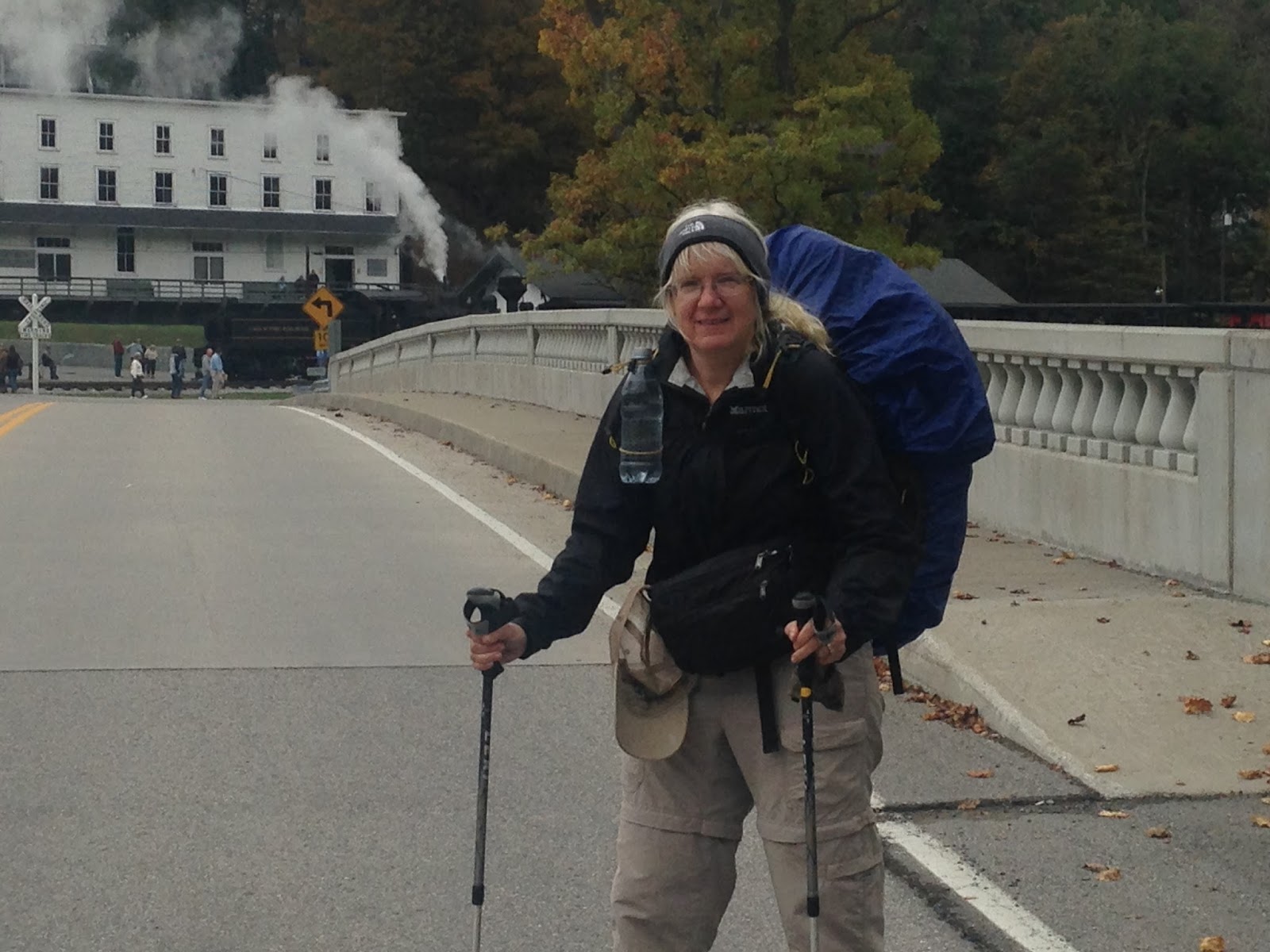
There is nothing more frustrating than experiencing an injury that keeps you from doing what you love to do. Especially hiking. After completing a three-week journey on the Allegheny Trail, I came home, did too much, and ended up with severe hip pain and sciatica. Diagnosis - hip separation and muscle overuse (possible piriformis syndrome). Right now I have a tendinitis issue from compensation due to a fracture in my toe after stubbing it on a rock. My third AT completion attempt is now on hold.

So now I am sidelined. I am no longer a happy hiker, enjoying what the trail has to offer, but resigned to icing, Physical Therapy, and simple walks. I’ve had injuries that have given me issues for many years. It’s not an easy thing to deal with when you are active.

So what do you do when injury strikes?


1.      First off, if you’ve suffered an injury, don’t be brave and keep hiking on it. You’ll just do more damage. Pain and swelling is your body's way of trying to tell you to STOP. So stop hiking. Period. (I only got off trail when the humidity and foot pain became too much. Later, I found out I had hiked over 70 miles on a broken big toe!).

2.      RICE. Rest, ice, elevation, compression.  DO it immediately after an injury happens. Don’t wait 24 hrs. It impedes the healing process. And be sure its ICE. Don’t ever put heat on an injury. If your stomach can handle it, taking ibuprofen (Advil) helps ease the inflammation. If you can’t, Tylenol helps with pain. Turmeric is also an anti-inflammatory.

3.     See the doctor. Many times, you can try to deal with the injury at home. But in my case, I did not wait as things were not improving. Sometimes it's good not to wait, to ward off other issues (like scar tissue forming). In severe cases with major swelling, pain, etc., you need a doctor to evaluate it. You may need x-rays to make sure something isn’t broken (I could walk with my injured toe, but only an X-ray showed I had indeed fractured it). You may need physical therapy to get back in the groove as soon as the injury allows. With the cost of medical care, sometimes this is put off. Only you know how bad it is.

4.       Eat nutritious food. If you are going to be sidelined for a while, be sure the food you eat is good for you. Don’t eat sugar and useless carbs thinking it will make you feel better. It won’t and may even worsen things. Protein, fiber-based foods, and lots of water are important to the healing process and for your well-being.
.
5.      Try not to get depressed. Easier said than done, especially when you see your buddies hiking and you’re sitting. But most have suffered like you have in one form or another. Most have been sidelined. Think of this as rest time to do other things that maybe you haven’t done. Think of the projects you can accomplish while you’re mending. Be sure to be outside too as sunshine is important to elevating your mood. Talk to others who have had injuries. Above all, give yourself time to heal by giving your body (and you) a break.

6.       Engage in other physical activities that don’t aggravate the injury. I have an exercise bike. Yeah, I hate the thing. But it’s better than nothing for cardiovascular means. A swimming pool works wonders also. Do some strengthening exercises (check online for exercises that have to do with your injury to begin rehabilitating it when the pain allows). Stay involved. When you are able, return slowly to your activity. Don’t push it or you could find yourself back at square one.

7.       Above all, be patient. It takes time to heal ligaments, tendons, and bones. Let your body do its job. Then you will be raring to go and ready to tackle that trail in no time. Remember, the trail is going nowhere. You will be back when the time is perfect.


Related Blogs


Thursday, October 13, 2022

Lessons Learned from an October Section Hike on the AT – Damascus to Bland

(Repost of a section hike and lessons learned)

Continuing my third round of completing the Appalachian Trail with a lengthy hike of over 120 miles. My only catch this time is I had eight days to complete it. Thus it required me
The climb north to Buzzard Rock yields a great view
to do heftier miles for longer periods of time (averaging 15 miles) and without rest. It also occurred during a drought time on the trail which has seen little in rainfall.

Water Issues. I talk about this issue in another blog, but my trip required a good idea of reliable water locations. I carried the guidebook pages and maps. I did ask hikers along the way what water was available and most had a hard time remembering. But what I did hear at least boosted my confidence that there was fairly adequate water availability.

Most bridges went over dry areas unless they were bigger creeks
Murky Water sources. The evening of Day One saw me camped by a black pond as my water source. In all the miles I have hiked, I have never had to pre filter water. But in this case it was a must to avoid the sediment clogging my Sawyer filter. I took a bandana (glad I had two with me for this hike!) and ran the water through. The bandana worked perfectly to collect the dark sediment. I then filtered the water through the regular Sawyer filter. While the water was still discolored, it was free of particles and treated.

Elevation and Weather. It pays to know the weather ahead of time. The hike began in summer-like
Snow and cold wind on Chestnut Knob
70s but I knew at the end I would face cold conditions. What I didn’t count on also was snow on Chestnut Knob! SO I had both extremes, warm and snow in a week section hike. Be sure to check the weather up to the minute and prepare for weather extremes, taking into account the elevation in which you will be hiking. I felt weird carrying cold weather gear at first, esp. with hikers bouncing along with light packs for the summer temps, but at the end of the week, I used everything I had and glad I packed what I did.

Other Hikers. I must say, on this trip I met the friendliest hikers out there. Everyone greeted me. I saw lots of southbound thru-hikers also as they are heading for final destination of Springer Mtn in GA, only weeks away (and boy were they happy!). It was great to see such a collection of friendly hikers out there enjoying the trail. The only issue I saw among most – no one was wearing blaze orange!!

Animals. In this section of trail it is not so much the bears but ponies and longhorn cattle! In several instances, the cattle stood directly on the trail. The horns were quite intimidating, I must say. I did

what I usually do with bears, talked to them like my dogs in a confident manner and they thankfully moved. But it was still nerve-wracking.


Overuse. Because of the persistent high miles over rough terrain, I am now nursing a fairly bad anterior tibial tendonitis on my right leg. Even after four days of basically no walking t is still bothering me. So the rule is – don’t overdo or you will suffer the consequences! And that is something I ought to know by now! Check out tips on my Overuse blog.

Sunset at Thomas Knob Shelter


Observations and Lessons Learned on Section Hikes Series:


Tuesday, July 05, 2022

Where Should I Go? Six Things to Consider When Determining Your Hiking Trip

There are so many places. So many trails. So many adventures waiting to be had.

Lots of trails. Lots of choices. 

What to do? Where to go? 

First, take a deep breath. Yes there are lots of places to explore. Maybe this is not the year though to do the big trails. The shorter trails, even trails in your own state, can bring great satisfaction and unique experiences than just the big trails we always hear about. No one heard of the Allegheny Trail in West Virginia which I thru-hiked in the past. It doesn't get the major press and hoopla. But wow, did I learn a lot by doing it. And grew in my hiking knowledge that I can now share with others. And it ended up being the catalyst for the Florida Trail the following winter. One never knows where a hiking adventure will lead. 

My finish of the 1100 mile Florida Trail, Feb, 2018

If you are planning a big one – like a multi-day backpacking trip, take a few things into consideration in planning. Some say you can just drop everything and go. Not wise. By taking the time to think things through that maybe you hadn’t yet considered, you will be steered towards that perfect trip meant for you! And without the distractions, misplanning can cause.

1.       Time. Do you have the time to do the trip you are considering? Will you need to take vacation time from work? Or a leave of absence for a major hike? Take into consideration how long the trip will take. You won’t be able to do 20-mile days. A 50-mile trip may take you five days. Plan accordingly.

2.       Money. It takes money to do a trip. Money for gear. For traveling to and from your destination. For expenses on the hike. For paying the bills or other needs on the homefront if you will be gone for an extended period of time. Be sure there are the finances to do this. Don’t think – oh, I will earn money on the way. Or I can skimp on things along the way. Or raid hiker boxes, etc. More often than not it never works out the way you think it will in the comfort of your home. Always plan for more money than you will need. Save up and be self-sufficient.

3.       Physical State. How are you physically? It is important to know if you are able to hike safely the trip you have planned. Even weekend getaways. Carrying a backpack is not the same as walking or running. It uses muscles differently, especially bearing a full load. For instance, if you are having knee issues, it’s doubtful they will suddenly go away on a hike! So take care to get checked out by the Dr. Get fixed what needs fixing so you don’t exacerbate a condition. If you need to change shoes do so. Work on physical strengthening, etc., do it. And make sure you have the proper gear and you are not burdening yourself with lots of extra weight that can rapidly turn a trip into a grueling experience. Learn from others on what to bring and what not to bring.

4.       Social Aspects. Are you going on this hike with others or going alone? Both need planning. For instance if going with a buddy, do you both hike roughly the same pace? Can you live with that person for an extended time? If the buddy must leave the trail on a long-distance trek, can you go on alone or are you sharing gear? Decide who carries what gear or if you should carry your own (which is a better idea). If you are going solo, prepare with your safety in mind. Maps, a cell phone, a guidebook, knowledge, even some personal safety devices like the Garmin Inreach. Are you also ready mentally to spend days and nights alone? Much of this can decide the kind of trip you want to do.

5.       Gear. Do you have the gear for the season and the area you plan to hike? Research ahead of time what you are going to need to accomplish your adventure. Adequate footwear, clothing, outerwear, sleep and cookwear. The backpack. All important. But remember, gear first, backpack last. Make sure you know weather conditions ahead of time and prepare accordingly for whatever you might face.

6.       The Mental Aspects. Are you accomplishing a hike to chip off sections on the AT? Doing a thru-hike of the John Muir Trail? Or going on your first expedition? Are you seeking waterfalls or a great view? Or another hiking challenge. Whatever it is, be sure your heart and mind are into it. The mental aspect of a hike is the number one thing that can kill it altogether if you are not ready and eager to get out there and experience the lows as well as the highs. The good and the bad. All of it is a learning experience. Stay positive even in the hard stuff. Limit expectations and take it one day at a time.

By looking at these different aspects of a hiking journey, you can better prepare for the perfect trip to fulfill your hiking dream this year. 


Wednesday, August 05, 2020

The Wonders of Hiking and Exploring our National Parks


The Wonders of Hiking and Exploring our National Parks


Backpacking Yellowstone in Shoshone Geyser basin
Backpacking Yellowstone in the Shoshone Geyser Basin

The national parks are the people's parks - created to protect the wide diversity of scenic beauty, flora and fauna as well as preserving these unique splendors for generations to enjoy. Established in the 1800's with the creation of Yellowstone National Park in Montana, the parks yield a great playground of opportunity for the outdoor enthusiast. From the volcanoes of Hawaii to lofty mountains of Denali and Rainier to the Everglades of Florida and the rocky seashore of Acadia in Maine, the parks offer a wide variety of opportunities in exploration and enjoyment. 

I grew up with yearly family adventures to our national parks like Glacier in Montana and Carlsbad Caverns in New Mexico, extending that enjoyment to my adult years where I spent part of our honeymoon watching lava flow into the ocean at Hawaii Volcanoes National Park and later on, working along the Appalachian Trail in Shenandoah National Park as a ridgerunner.

Before you venture to the parks, check out the official park website and their Things to Do section that offers park highlights. Once at the park, head to the visitor center where friendly rangers and park volunteers can help you decide on the best adventure in the time you have. 

Mt Rainier

Some of my favorites include

The Giant Sequoias of California
Great Sand Dunes in Colorado
Mt Rainier of Washington State
Glacier in Montana
Arches and Bryce Canyon in Utah
Acadia of Maine
Shenandoah in Virginia

If you plan to venture into the backcountry of a national park for hiking and camping, check out the park's regulations. Most parks require a backcountry permit. In some the permits are free, in others a fee is required. Some parks require you to watch a safety video. Some parks require that you reserve a specific camp area or site. Check out also on bear proof technique for your food in each park as some have different regulations. And be sure you have the appropriate gear and footwear for the terrain and seasons in which you are hiking and camping. 

Exploring Bryce Canyon, Utah

With a bit of planning the national parks offer a wide variety of fun and exciting opportunities to enjoy the splendor of these unique places in the United States. 

Check out Blissful Hiking Adventures to listen to this and other episodes on our podcast and the Hiking Adventure Series on our National Scenic Trails in print and e-book!


On Lassen Peak!


Friday, July 24, 2020

A Day in the Life of a Hiker on the Trail - and the Lesson Learned


A Day in the Life of a Hiker on the Trail - and the Lesson Learned 

Shared by Ryan Michael Beck

photo: Ryan Michael Beck

Yesterday was by far one of the hardest days on the trail (top 2 to be specific). Now before I go in to some details, I am not looking for encouragement and in no way plan on stopping. I just want the reader to understand that while chasing your dreams and fighting for what you love, takes hard work, is rarely easy, and sometimes makes you want to lose your mind ...
It was my first early morning in over a month, I was planning a 20 mile day. The first part was going to be hard (5,800' up 4,200' down over 13 miles) I knew there was not a lot of time to mess around and by 7:30, down the trail I went.
Early into the day I was crushing it. I mean it felt good being on the well groomed trails of Maine. I don't normally use trekking poles but the terrain was so nice I had too. That was my first mistake and I did not even know.
Around 11 o'clock I got some horrible news, one of my hiking partners (since 1/2 way point) was going home. I had not seen him in a few days, come to find out he had been hiding an injury and was unable to move his knee. This was devastating on multiple levels. First here was my friend, someone I looked up too and through hardship developed an incredible bond with. This also ment (sic) my other partner, who is younger and faster than me would probably move ahead without me. On top of the fact that the whole situation made me questioning my own bodies capabilities.
After that phone call the day particularly when to shit. I don't know if you know, but the mud and bogs on top of mountains is a plain and one miss step can have you knee deep in the grossest mud you have ever seen. Well that happened only twice on this trip...and it was yesterday. Side note trekking ploes (sic) are horrible in the mud.
Another thing that's hard to do out here is stay hydrated. That leads me to the next crap part of the day, I was using the forest, thinking about how my pee was dark and very smelly, when a black fly bit my forehead. I dropped my fany (sic) pack to slap head, but then I had a bigger problem. The fany (sic) pack landed in the stream and I got covered in my own disgusting urine. This is about the point I mentally started losing my composure.
It was only 11 o'clock and I was fading. I began the climb up Old Blue mountain. 3,800' of fun. So I climbed and climbed and climbed. My neck and back where sore from a poor night's sleep. And it seemed like the climb would never end. I made it to the top by 1. That's 5 hours to go 7.4 miles. Before I got to the top, with every step I was cruising the mountain. I don't mean figuratively but very loudly and not very kind words. But I did make it to the top.
3 bad things happened at the top of that mountain and the servaratiy (sic) would not be realized until later. First I called a friend who was picking me up in a few days and scheduled a meeting place, this cemented me to finishing 13 more miles that day. Second my younger travel partner showed up and confirmed that he was moving on ahead of me. Third I did not eat lunch, super bad move.
At 2 I hit the trail again after the final goodbyes. What I did not know is my body was completely toast. After a long break it can be hard to get moving again. So much so, some people don't take breaks during the day. I thought that I just needed to get moving and all would be better. Plus the second half of the day was going to be easy, well it was not.
The up's just kept coming, the map looked flat but the mountain was not. I climbed and climbed and climbed. My phone battery was low so no music. By this point I was really inside my own head. A miss marked trail made me think I was 2 miles a head of where I was. Walking more than 20 minutes without stopping to take of my pack and rest was out of the question.
At one point I slipped on a wet rock, in a fit on rage i broke my trekking poles. While in the monument this felt great, it was the point where I lost all control and salvaging the day was not going to happen.
By the end of the day I called my wife and told her I was never going to meet my friend, there was no way I could do the miles. She said she would help, but needed more info. Well my phone with 3 bars of 3G won't send a text message. I am at my witts (sic) end. Its was almost 5 by then and I had gone 5 miles past Old Blue and still had 1 mile to go so that I could have water and stay in a shelter.
I did finally make it to the shelter and got text too my wife and she coordinated a closer pick up spot for my friend.
As bad as the day was and as bad as I wanted to give up, I knew everyday brings new experiences. The challenge is rarely the obstacle, its finding a way to extract as much value as possible. I confronted demons yesterday, I was more exhausted than I had ever been, but that reminded me how bad I want to finish and what I am willing to go through to achieve my dreams...

(Bravo! Despite the obstacles, never give up on your dream and keep pressing forward - Blissful)


Wednesday, July 01, 2020

Get Out of the Box and Explore


Get Out of the Box and Explore – An Interview with Hiker Blissful

In Episode Two, Lauralee Bliss, trail name Blissful, shares with listeners her motivation for hiking and exploring the trails. This interview was conducted by WhiteFire Podcasts about long distance hiking adventures and other interests with valuable lessons learned along the way.

What are the differences between hiking the Appalachian Trail vs the Florida Trail?
The Appalachian Trail or AT is widely recognized, being next to many major
metropolitan areas of the east coast, with books and movies about it. It has plenty of mountain adventures and is good for short term hikes. And it was the hike Blissful did as a long hiking adventure with her teen son.

The Florida Trail is a low elevation trail with flora and fauna inherent in a southern state. It gives a different perspective of wilderness set in swamp, palm trees, palmettos, with fauna and flora all its own. It provides good long-distance adventure in the winter. Blissful gives examples of the challenges found in a solo hike.

What is your background?
Lauralee Bliss, trail name Blissful, grew up in the Catskills of New York with a mountain in her backyard. Blissful enjoyed traveling in the family RV to destinations where great hikes abounded, including the Appalachian Trail. She lives the adventure rather than just talking about it due to a goal driven mentality and seeing a dream fulfilled with no regrets.

How did you accomplish your hikes?


Read about it, set a plan into motion, hear from others who have done it in podcasts such as this, on hiker forums like in Facebook, in chats, in webinars and other video platforms. Learn what gear will work and what won’t. Read a lot, a dream a lot, then do it.

Final Thoughts
Blissful realizes life is crazy. But you can turn the craziness about into an adventure that may seem crazy to others but actually becomes a trail to healing and learning much about yourself and others. Make life count, and when you go through those adventures, tell others. Don’t keep it to yourself. It’s not just about you.
So get out of life’s box, explore, and share it far and wide!


Never miss an episode! Be sure to subscribe to the Blissful Hiking Adventures podcast.
Don’t miss Episode 3 - Hiking and Exploring in our National Parks
Coming Soon – Running those Ridges, the Life of a Ridgerunner on the Trail

Also available, the Hiking Adventure series of books on the Appalachian Trail (both north and south) and the Florida Trail from these sources:
Barnes and Noble - Florida Trail and Appalachian Trail


Wednesday, October 02, 2019

I Need Water! 7 Things You Can Do in Dry Conditions

Fall is here and yes, with the lack of rain, water can dry up.

Here are some reminders on what you can do when water is low on the trail -


1.     Try to schedule your hike when there has been rainfall. Easier said than done when you can only go at a certain time. But if you have flexibility, do it. Check in with hiking social media to get updates if possible. If need be, alter your hiking plans to a different area that has better water availability. Some areas also institute burn bans due to fire danger. Check ahead of time for these issues before you leave.

2.       Take an updated guidebook that will tell you when sources are reliable or unreliable. For instance AWOL’s AT Guide for the Appalachian Trail tells you when source are reliable. And those not marked this way for me were dry. Also, you need guidebooks of potable sources in towns etc. On the heels of this, take a map or use a map app on your phone. Maps can identify water sources – esp. springs, streams, etc that may not be in your guidebook. Or it will let you know if a water source is flowing from a beaver pond or a field or a road, of which you then need to treat with care. It will also tell you where you might want to camp that night.

3.       Take extra water containers. When in a dry section, you may need to tote water for a considerable distance. Take extra Platypus containers, empty water bottles, etc. Adjust your pack weight and how you carry items in your pack to adjust for the extra water (a liter of water weighs about 2 lbs). 

4.       When you see a water source, fill up. Hydrate too. Check your map, if it has been very dry, you may need to err on the side of caution and take an extra few liters with you. Plan your mileage accordingly if you need to carry extra weight.

5.       Plan non cook meals. This will use less water.

      6. Make sure you have adequate water treatment (chemical, Sawyer squeeze, Steripen, Pump)


      7. If things get tough, don’t be afraid to ask a neighbor, business, even a home for water. Sometimes you need to do what’s safe. If all else fails and there is none, get off the trail. Better to be off and hike another day than get dehydrated or worse.

It can be tough trying plan for water conditions, especially when there has been no rainfall. But with some planning and flexibility, you can make it through the driest of times.


Related Blogs 


Sunday, January 07, 2018

5 Ways to go-fund Your Long Distance Hike


I just saw a post on a Facebook group of two hikers that set up a fundraiser on GoFundMe so folks can donate to their upcoming long distance hike. I must say, it raised my ire. To ask for money to fund a hike when there are people that need the cash--their house burned down, their loved ones are facing incurable illnesses, they have fallen on bad times—seems selfish and immature to me. It shows a lack of discipline, determination, and independence. It also shows a lack of planning for a venture.
A hike is not a necessity. It isn’t something one must do to survive. It is, for all intent and purpose, a trip for pleasure. Some say a vacation even. I myself waited thirty years for the funding and the right time to do my hike. 

But a long distance hike is a pricey adventure when one considers gear, travel and the hike itself. So what are some legitimate and worthy ways to raise the money you need to fulfill your hiking dream?
Here are some ideas.

1      Save. This is the most obvious but one that is overlooked. We are not a saving society but a spending society. It takes great patience, determination and discipline to set aside money. And that determination and discipline ultimately transfers to a hike itself. If you take the time to save and fund your hike, it will mean more to you anyway. So put away cash bit by bit over time. Say no to that caramel macchiato at Starbucks and put it in your account instead. Maybe don’t eat out. Look for other ways to cut money out of your daily/weekly/monthly budget and put it in a hiking savings account.

2       Work overtime at your present job. Or look for an extra job on the side like temporary work to make
some bucks. Seek extra opportunities. Even shovel snow off driveways, mow lawns, pet sit. Be disciplined.  

         3. Sell things. I have seen hikers sell used gear on Craigslist, used hiker sites, yard sales, etc. to raise money for their hikes. Or if you are creative and want to make items to sell on Etsy, etc. do that too.

          4. Look for ways to budget on your upcoming hike. There are blogs here on Blissful Hiking on how to hike on a budget. Realize right out that you may not be able to stay at the fancy places, take lots of zero days, or indulge in food and drink. Check out the blog on a hiker that did an AT hike on $1000. But that doesn’t mean you become a beggar on the trail either. Live within your means and the money you have. But realize you don’t need the most expensive or fanciest gear either. Look around for deals on your gear, clothing, etc.    

5.       Don’t go on your hike until you are financially ready. Too many strike out then find they are spending way too much and have to abandon their hike due to lack of funds. Don’t let this be you. Have the money you need before you go. The trails are not going anywhere. Save up and go when the timing is right. You’ll have a much better opportunity then to be successful in fulfilling your hiking dreams and goals.  And the hike will mean much more to you, too, when you can say – I hiked it AND I paid for it with hard work and determination.

Related Blogs


Sunday, August 13, 2017

The Colorado Trail - Part One - Preparing for the Long Distance Hike

This year I am embarking on a new long distance venture that will take me into high altitude for multiple days and away from the typical eastern US hiking trips I have enjoyed in the past.

My plan is to hike the 486 mile Colorado Trail (CT) that extends from Denver to Durango in the beautiful and wild Rocky Mountains.

Most hikers plan their trip to leave from Waterton Canyon south of Denver and hike southbound, arriving some four to five weeks later at Durango. Typically the main season begins sometime in July and ends in August. For me, since I am starting later in the season and because of possible snow in September at the higher elevations close to Durango, I am hiking northbound to Denver. This necessitates me to do more planning, such as acclimating, watching pack weight for long stretches of resupply in areas, and planning for shorter days at the onset to help me adapt to the high altitude and the stretches of tough climbing.

My planning for this trip began several months ago by joining a Colorado Thru Hiker Facebook Group. This place on social media has been an invaluable tool for the beginning steps needed to do the trail. Much information is shared—from resupply options, to acclimating (of which there is a special Facebook group specifically for that), gear, travel options, and yes, I have even met great trail angels willing to help me out on the trail. The  Colorado Trail Foundation will also email on request a list of shuttlers willing to transport you to towns or trailheads.
A Map App helps with navigation

Once the plans are made, important trail resources are needed. I downloaded the trail app from Atlas Guides (formerly Guthook). I am quite familiar with the map app on my phone, having used it successfully on the Florida Trail. Hikers have also left notes on the app for water resources and waypoints, which allows me to check on water availability late in the season. I also purchased the Colorado Trail Foundation’s data book for the trail. Both resources have proved invaluable for planning purposes. A Trail Foundation can be a wealth of information as to trail conditions – be sure to see if they have a social media group online as well, along with guidebooks and print maps. I have even called the foundation office to ask questions.

Mail Drop Prep
I then spent time gathering gear and also food and supplies for some mail drops. While the scene to the left looks a mess, maildrops give me the option to eat the foods I want while not spending valuable time trying to figure out options at a grocery store. The End to End Colorado Trail guide assists in this kind of planning.   


All these resources together, coupled with information shared from other hikers’ experiences, helps one plan the best they can for a journey into the wilds of the Rockies.

(Note – the above information can be used toward any long distance hiking trail as far as planning such as the use of social media outlets, trail foundations, guidebooks and maps)

Summary of Resources:


Thursday, May 05, 2016

Plan Ahead and Prepare for that Trip!

I thought it was good to repost this. I was out during the FIRE in Shenandoah recently and found hikers woefully unprepared for what was happening. Not only did they NOT know about the fire and the closed trails (!), but did not plan for water in dry areas or their hike in general. Every season as a ridgerunner I see backpackers failing to plan and prepare for their trip They end up miserable, possibly in danger, or having to end the journey prematurely. Because of it, they lacked what was needed to help ensure a timely and safe hike. Others do not seek out the regulations in the area where they plan to camp - such as securing permits for Shenandoah - and must alter their plans


With that in mind, I have taken principles from the Leave No Trace web site to help illustrate some good ideas when deciding on a hiking trip. Plus I add a few of my own.  

"Adequate trip planning and preparation helps backcountry travelers accomplish trip goals safely and enjoyably, while simultaneously minimizing damage to the land.

PRE-TRIP PLANNING
Poor planning often results in miserable campers and damage to natural and cultural resources. Rangers often tell stories of campers they have encountered who, because of poor planning and unexpected conditions, degrade backcountry resources and put themselves at risk.

WHY IS TRIP PLANNING IMPORTANT?
You may want to create additional answers for this list:
  • It helps ensure the safety of groups and individuals.
  • It prepares you to Leave No Trace and minimizes resource damage.
  • It contributes to accomplishing trip goals safely and enjoyably.
  • It increases self-confidence and opportunities for learning more about nature.

SEVEN ELEMENTS TO CONSIDER WHEN PLANNING A TRIP

  • Identify the goals (expectations) of your trip.
  • Identify the skill and ability of trip participants.
  • Select destinations that match your goals, skills, and abilities.
  • Gain knowledge of the area you plan to visit from land managers, maps, literature and online resources.
  • Choose equipment and clothing for comfort, safety, and Leave No Trace qualities.
  • Plan trip activities to match your goals, skills, and abilities.
  • Evaluate your trip upon return note changes you will make next time.
CONSIDER Also:
  • Weather
  • Terrain
  • Regulations/restrictions (permits, camping areas, fires)
  • Private land boundaries
  • Average hiking speed of group and anticipated food consumption
  • Group size (does it meet regulations, trip purpose and Leave No Trace criteria?)
  • Water availability
Meals are another element to trip planning that can have a profound effect on the impact a group has on a backcountry area.

Benefits of Good Meal Planning:


  • Reduced trash.
  • Reduced pack weight, resulting in faster hiking times and less fatigue.
  • Reduced dependence upon campfires for cooking.
  • One-Pot Meals and Food Repackaging

Planning for one-pot meals and light weight snacks requires a minimum of packing and preparation time, lightens loads and decreases garbage. One-pot meals require minimal cooking utensils and eliminate the need for a campfire. Two backpack stoves can be used to cook all meals for large groups if you have two large pots (one large pot can be balanced on two stoves when quick heating is desired). Don't rely on campfire cooking (and please, do not make aluminum foil HOBO meals. I have seen too much foil left in campfire rings). Most food should be removed from its commercial packing and placed in sealable bags before packing your backpacks. Sealable bags (like ziploc bags) secure food and reduce bulk and garbage. Empty bags can be placed inside each other and packed out. This method can reduce the amount of garbage you must pack out at the end of the trip and eliminate the undesirable need of burying unwanted trash or burning it in a campfire (NEVER burn your trash!)"


Other things to consider. It's important to know before you go. Know where you are going. Know your physical limits, especially as you are carrying a backpack over uneven terrain. Bring maps, compass, guidebooks of the area you plan to hike. There are map apps for your phone. In some areas it's good to have a GPS device. Familiarize yourself with the area. Bring a cell phone for emergencies. Know first aid and what to do in an emergency, for unplanned weather, or if you are injured. Bring adequate clothing and equipment like a good tent (don't rely on trail shelters) and water purification. Always pack an extra day of food in case you must stay for an extra  day because of bad weather. Don't rely on fires to keep you warm but have a good sleeping bag and warm weather clothing like merino wool underwear, an insulated jacket, a hat, and rain gear. Be sure to keep your sleeping bag and clothing dry at all costs.

Don't let poor planning and preparation ruin your dream.  


Wednesday, April 22, 2015

Flip Flops - or Going Against the Norm

On May 2nd and 3rd the Appalachian Trail Conservancy will be hosting what will be an annual event each year. A Flip Flop Hiker Kick-Off Festival in Harper's Ferry, WV. When I mention flipflop this is what people assume -


But in hiking circles, a flip flop actually refers to an alternate method of completing a long distance trail. That is - not going from end to end but rather hiking the trail by alternate starting and end points.

The trails are getting busier. Already there are rumors of over 3000 starting the Appalachian Trail down in Georgia this year. And that number will likely increase as Hollywood makes known the trial
I finished my southbound hike at Harper's Ferry. It was great.
in the media and word spreads. Thus it's important to get out the word about other ways to enjoy and accomplish the trail. Like a Flip Flop.

For most AT hikers, the flip flop normally consists of jumping off at Harper's Ferry, WV for the trip north. The hiker hikes to Katahdin, returns to Harper's Ferry and heads south during the fall season for a finish at Springer Mnt, usually round early November. A flip flop has the advantage of not only missing the huge masses of thru hikers flowing from GA but also the enjoyment of seeing the trail in good weather, usually without the snows, cold, and other issues. And great fall colors in the south if you end there.

Some other alternate ways for a flip flop hike are as follows (from the ATC website)

HEAD-START FROM HARPERS FERRY (RECOMMENDED BY ATC)

Harpers Ferry, W.Va., north to Katahdin; Harpers Ferry, W.Va., south to Springer Mountain.
Summary: For a two-part flip-flop, this version hits the sweet spot between crowds and loneliness. It begins with the easiest part of the entire A.T., reduces exposure to extremes of weather, and starts in one of the prettiest and easiest-to-get-to spots on the Trail.

Sample itinerary:
 Start in Harpers Ferry late April or first half of May, reach Katahdin second half of August; return to Harpers Ferry after Labor Day; finish at Springer Mountain the second half of November.
  • Start in easiest part of the Trail that very gradually gets more difficult.
  • Start in mild, pleasant weather.
  • Start amid spring wildflowers and walk north with spring.
  • Do not expect to keep pace right away with thru-hikers who started in Georgia.
  • Encounter rocky but mostly flat terrain in Pennsylvania 
  • Hike through the mid-Atlantic before it gets hot, humid and water sources become scarce.
  • If you start earlier than May, make sure you do not reach Vermont before mud season ends (Saturday of Memorial Day weekend). 
  • Reach the White Mountains in July, before the peak crowds; less competition for work-for-stay in huts
  • Reach Maine in August, when black flies are gone (but expect crowds the last hundred miles of Maine).
  • Plenty of time to reach Katahdin before it closes.
  • No advance reservations required for Baxter State Park  (eligible to use The Birches long-distance hiker's site)
  • Wait until after Labor Day to start southbound from Harpers Ferry to give the earliest southbounders time to catch up with you.
  • Walk south with fall colors on the second half of your hike.
  • Companionship with early northbounders the first half, then finish the Trail with early southbounders.
  • Be prepared for hunting season in the South.
  • Be prepared for cold weather and the possibility of snow starting at the end of October, especially in The Smokies.

HEAD-START FROM DAMASCUS, VIRGINA NORTH 

Damascus, Va., north to Katahdin; Damascus, Va., south to Springer Mountain. 

Summary:Allows you to start earlier than some options, but you can expect cold weather much of he first month, and a solitary hike on the final leg southbound from Damascus.

Recommended Itinerary: Start in Damascus mid-April, hike north to climb Katahdin mid-September; resume hiking south third week of September, finish on Springer Mountain beginning of November. 
  • Start ahead of biggest crowds of thru-hikers, but be assured of companionship from early hikers.
  • Be prepared for snow and frigid temperatures across the 5000-foot-plus Mt. Rogers highlands (a 26-mile high-elevation stretch that starts about 17 miles north of Damascus).
  • Be prepared for the possibility of below-freezing temperatures anytime in April since you'll be in higher mountains
  • Do not expect to keep up with the pace of thru-hikers who started in Georgia; allow yourself 3-6 weeks to get in optimal shape.
  • Start out in terrain of moderate difficulty.
  • Plenty of time to reach Katahdin before it closes.
  • Enjoy fall colors in the deep South, but expect no fellow travelers (you'll be ahead of the southbound thru-hikers) 

HEAD-START FROM NY/CT NORTH

Southern New England north to Katahdin; southern New England south to Springer Mountain.
Case study: “Scatman” started on the NY/CT line mid-June and hiked northbound, climbing Katahdin mid-August. He returned to starting point in NY and headed south with the southbound thru-hikers, finishing the end of November.
His comments: “I believe that beginning in Connecticut in early June was beneficial. By hiking southbound for most of the trip, we also avoided the crowded shelters and the 'spring break' atmosphere of the early part of a northbound hike. It also allowed me to 'follow autumn' for much of the southbound portion of my hike. We did experience some cold weather at higher elevations and some snow in the Smokies … Doing New England northbound also afforded me the opportunity to approach Katahdin head-on, one of the most exciting sights on the A.T.”

Transportation note: Public transportation is available weekends to the Appalachian Trail Stop in New York near the Connecticut border via the Metro North railroad line (between Pawling and Wingdale). More information is available on ATC' shuttle and public transportation list at www.appalachiantrail.org/transportation.

CLASSIC FLIP-FLOP

Springer Mountain north to Harpers Ferry, W.Va.; Katahdin south to Harpers Ferry.
Sample itinerary: Start at Springer Mountain second half of April and hike north, reaching Harpers Ferry, W.Va., middle of July; then flip to Katahdin. Hike south to Harpers Ferry and end first half of November.
  • Start at Springer Mountain, but without the crowds.
  • Minimal chance of snow or severe cold the entire hike.
  • Avoid heat in most of mid-Atlantic.
  • Reduced (but not eliminated) exposure to Lyme disease and tick-borne diseases.
  • Avoid crowds of other thru-hikers.
  • Advance campground reservations required at Baxter State Park (not eligible to uses The Birches Long-Distance Hikers site)
  • No worries about reaching Katahdin in Baxter before it closes.
  • Hike with late northbounders first half; hike with southbounders the second half and meet northbounders a second time.
  • Hike south with fall colors.


More Information on the Hiker Festival:
Appalachian Trail Conservancy Flip Flop Kick-Off Weekend